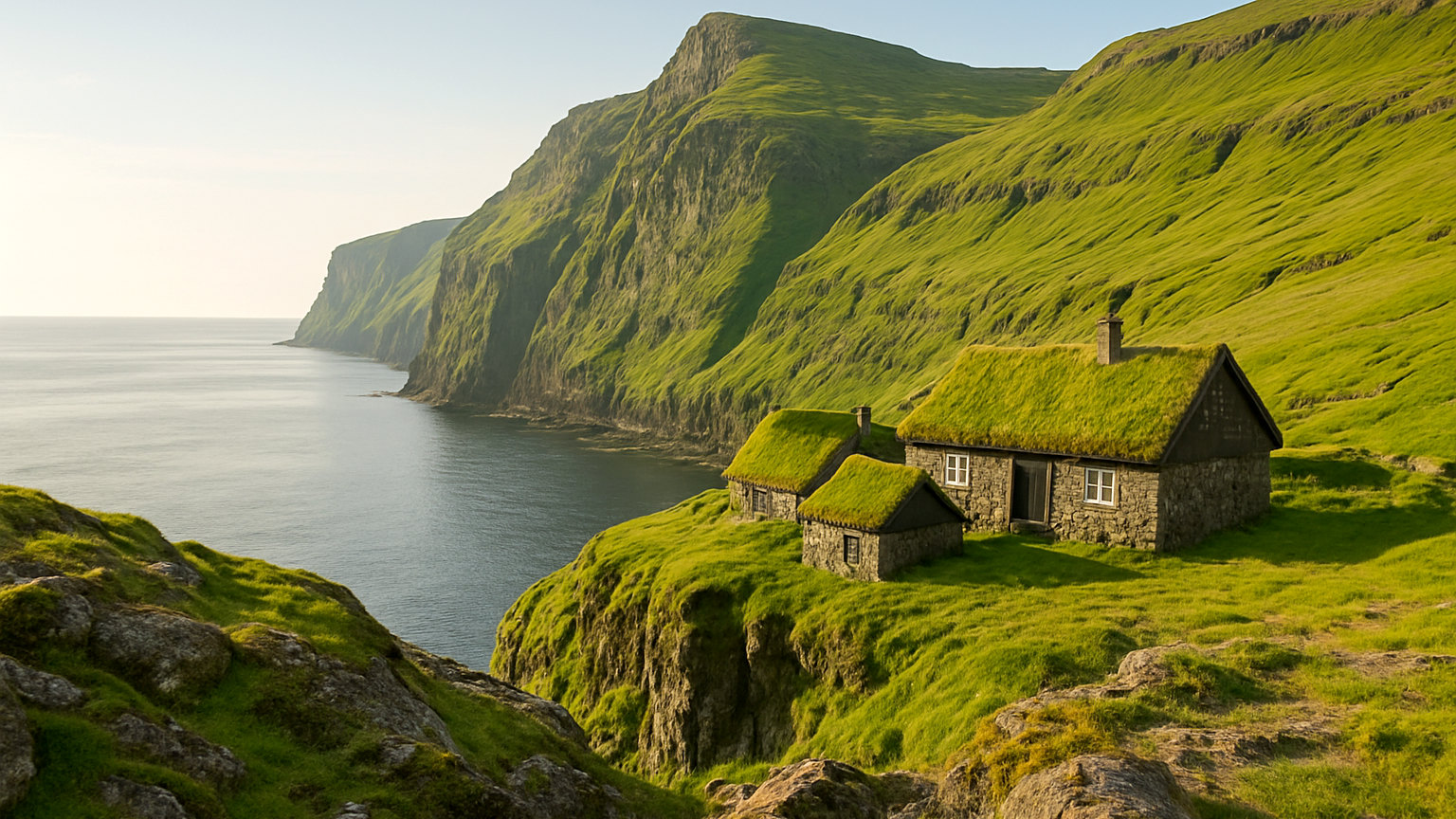
The Faroe Islands are eighteen volcanic islands in the North Atlantic between Scotland and Iceland, part of the Kingdom of Denmark but self-governing. There are around fifty-four thousand people and rather more sheep. The landscape is treeless green cliff dropping into deep water, and the weather is the single thing that decides what any visit is like.
What makes it different?
Scale and emptiness. Iceland now receives millions of visitors a year; the Faroes receive a small fraction of that. Villages of a few dozen people sit beneath thousand-foot cliffs, sub-sea tunnels connect the islands, and it is entirely normal to walk for an hour without seeing anyone. It is also compact, with most of the archipelago reachable from a single base.
How long do you need?
Five to seven nights. The islands are small but the weather means you should plan for at least one or two days being lost to cloud and horizontal rain, and the best sights need clear conditions to be worth reaching.
What should you see?
Gasadalur, a village with a waterfall dropping straight off the cliff into the sea, which is the image most people know. Saksun, a grass-roofed settlement above a tidal lagoon. Mulafossur and the Vagar lake that appears to hang above the ocean from certain angles. Kalsoy for the Kallur lighthouse walk. Torshavn, one of the smallest capitals in the world, with a turf-roofed old quarter on a promontory.
What is the walking like?
Excellent and often unmarked, on open sheep-grazed hillside. Several of the best routes cross private land and now charge a fee or require a guide, which is a recent and reasonable response to visitor numbers. Conditions change fast, cliff edges are unfenced and fog arrives without warning, so a map, proper boots and waterproofs are not optional.
What about the weather?
It is the defining feature. The islands can go through sun, fog, rain and wind within an hour, and the saying is that you may get all four seasons in a day. Temperatures are mild year round, rarely below freezing or above fifteen degrees, and it rains on roughly three days in four. Plan flexibly and keep the best walks for the clearest morning.
How do you get around?
A hire car, effectively. Sub-sea tunnels and bridges link the main islands, some tolled, and ferries and a helicopter service reach the outer ones. The helicopter is publicly subsidised and remarkably cheap, though seats are limited and booking rules favour residents. Roads are good, narrow and often single track with passing places.
How do you get there?
Flights to Vagar from Copenhagen, Edinburgh and a handful of other cities, with a limited schedule that thins in winter. There is also a ferry from Denmark via Iceland. Flights are frequently delayed by fog at the airport, so avoid a tight onward connection.
How much should you budget?
Expensive, at Norwegian or Icelandic levels, with accommodation and eating out the main costs. The currency is the Faroese krona, tied to the Danish krone. Self-catering and guesthouses reduce the bill substantially, and the landscape itself costs nothing beyond the occasional path fee.
When is the best time to visit?
May to August for the longest days, with June and July giving nearly twenty hours of light and the puffin colonies active. September has fewer visitors and more dramatic light. Winter is dark, very windy and many roads and ferries run reduced services, though the Northern Lights are occasionally visible.
What do people get wrong?
Planning a fixed day-by-day itinerary. The weather makes that useless. The second is underestimating the tunnel tolls and the fuel cost across a week of driving, both of which add up.
For the next step, see Sibenik: The Croatian Town Most Visitors Drive Past, or browse the full Destinations section.
The short answer
A week with a hire car, based near Torshavn or on Vagar, in June or July for the longest days. Keep the plan loose, save the cliff walks for the clear mornings, and treat the weather as the itinerary rather than an inconvenience.